The CEDAR Lab
🌲 Computational Ecology, Data Analytics & Remote Sensing
The CEDAR Lab builds computational methods and open-source software for understanding how forests and landscapes change — combining machine learning, satellite remote sensing, and spatial analysis to answer questions that matter for conservation, carbon, and biodiversity.
What CEDAR stands for
Computational Ecology, Data Analytics, and Remote sensing — the three strands that run through everything the lab does.
Computational Ecology
Turning ecological questions into models that can be run, tested, and re-run. Simulation of forest dynamics and disturbance sits alongside statistical inference from field and satellite observation.
Modeling Simulation
Data Analytics
Machine learning and spatial statistics applied to large, messy environmental datasets — with an emphasis on validation that holds up when a model meets a landscape it has never seen.
Machine Learning Spatial Stats
Remote Sensing
Openly licensed Earth observation — Landsat, Sentinel, LiDAR, radar — used to measure forest structure, composition, and change from the individual crown to the continental scale.
Earth Observation LiDAR
How we work
Code, methods, and — where licensing allows — data are released publicly. Software is archived on Zenodo so it carries a citable DOI, and analyses are built as reproducible pipelines rather than one-off scripts that only run on one machine.
The lab deliberately builds on openly licensed Earth observation and environmental data: Landsat, Sentinel, SoilGrids, LANDFIRE, and ESA WorldCover. Methods that depend on commercial imagery budgets are methods most of the world cannot use.
Research outputs are packaged so other people can actually run them — QGIS plugins, R packages, documented workflows. A result that stops at a figure in a paper is only half finished.
Methods are explained publicly through written tutorials and the GeoAI for Ecology YouTube channel, so that researchers without a computational background can pick these tools up.
People
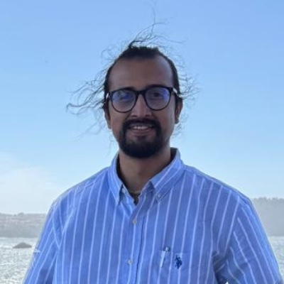
Sushil Paudel
Founder · PhD Researcher
Sushil founded The CEDAR Lab to advance open, reproducible research in geospatial ecology. His work combines machine learning, remote sensing, and spatial analysis to study forest and landscape dynamics, and he develops the lab’s open-source tools.
Join the lab
The CEDAR Lab is early in its life, and I’m interested in hearing from students, researchers, and practitioners working at the intersection of geospatial AI and ecology — whether that’s a joint analysis, method development, or applying the lab’s tools to your own study system.
Software
The lab’s software is developed in the open. Everything is free to use, inspect, and build on.
iLAND Workbench
A QGIS plugin bringing the iLAND individual-based forest landscape and disturbance model into a GIS workflow — runtime management, climate and soil data pipelines, and reproducible analysis. Archived on Zenodo with a citable DOI.
QGIS Plugin Python Released
forestPulse
An R package for analysing forest structure and disturbance from field plots and drone or satellite imagery, and for assembling the climate, landscape, and tree-initialisation inputs that drive the iLand model. Released under MIT with a citable DOI.
R Package R Released
Research themes
The lab’s active work spans four connected areas. Each is described in more detail on the research page.
Forest disturbance mapping
Detecting deforestation, degradation, and recovery from satellite time series, separating gradual change from abrupt clearing.
Landscape connectivity
Modeling how fragmentation shapes species movement, gene flow, and ecosystem resilience.
Spatial modeling
Species distribution and biomass models built with spatially aware validation.
Biodiversity assessment
Multi-sensor habitat characterization across scales, fusing optical, radar, and LiDAR data.
Follow the lab
GitHub
The lab organization, plus the repositories where the tools themselves are developed.
The CEDAR Lab · Tool repositories
Open Source
YouTube
Tutorials and explainers on remote sensing, GIS, R, and geospatial AI.
Tutorials